Ohio’s Year of the Trails: Three Major Trail Developments in the Buckeye State
It’s officially the Year of the Trails in Ohio, and the Buckeye State is building significant momentum on trail projects, from Cleveland to Cincinnati and beyond.
These projects are showing how cities and entire regions can leverage the impact of existing trails to create trail “spines,” and biking and walking networks that connect people and places—providing safe and healthy ways to get outdoors, while generating new economic opportunities that revitalize neighborhoods and communities.
If you want to learn more about the benefits trails are creating in Ohio and across the country, check out our campaign website.
However, there’s much more going on! Here are three projects that demonstrate why 2018 is truly Ohio’s Year of the Trails.
Northeast Ohio’s Trail Network Is Expanding
On Oct. 16, 2018, trail advocates, planners and elected officials celebrated how trails are transforming their community with an event in Euclid, Ohio. The event highlighted the Cuyahoga Greenways Plan—a joint effort to build an interconnected system of greenways and trails in Cuyahoga County—including a new riverfront trail in Euclid. The event also highlighted a unique local program by NOACA (Northeast Ohio Areawide Coordinating Agency), the Streets Supplies Program, which loans materials to municipalities for temporary transportation projects—like building a protected bike lane in Euclid at the site of the event! The hope is for the temporary lane to become permanent in the future to improve mobility for residents and commuters and encourage more people to bike to get where they need to go.
Related: Ohio Legislative Trails Caucus Helps Kick Off Ohio’s “Year of the Trails”
In nearby Cleveland, major trail developments are also promising convenient and safe connections for recreational and commuting purposes that transcend age and class. The Midway Protected Bike Boulevard Network will drastically improve connectivity between the downtown area and the greater metro area through 60 miles of protected, two-directional bike lanes—with a separate signal system. With a focus on creating connections in highly trafficked areas, the project will reduce the threat of bike-related injuries and help more people get to and from destinations citywide. An $8.3 million grant this year has helped the city start building the first phase of many to complete this network.
Other projects are leveling the field for biking and walking in underserved neighborhoods, like the Redline Greenway, which highlights rail-with-trail development along an active rail transit line while connecting 11 schools and several public housing communities, and the Downtown Connector trail, which has plans to link the diverse cultural heritage of the Slavic Village to popular destinations outside the city.
Southwest Ohio Celebrates the Long-Distance Ohio to Erie Trail and Local Protected Bike Lanes
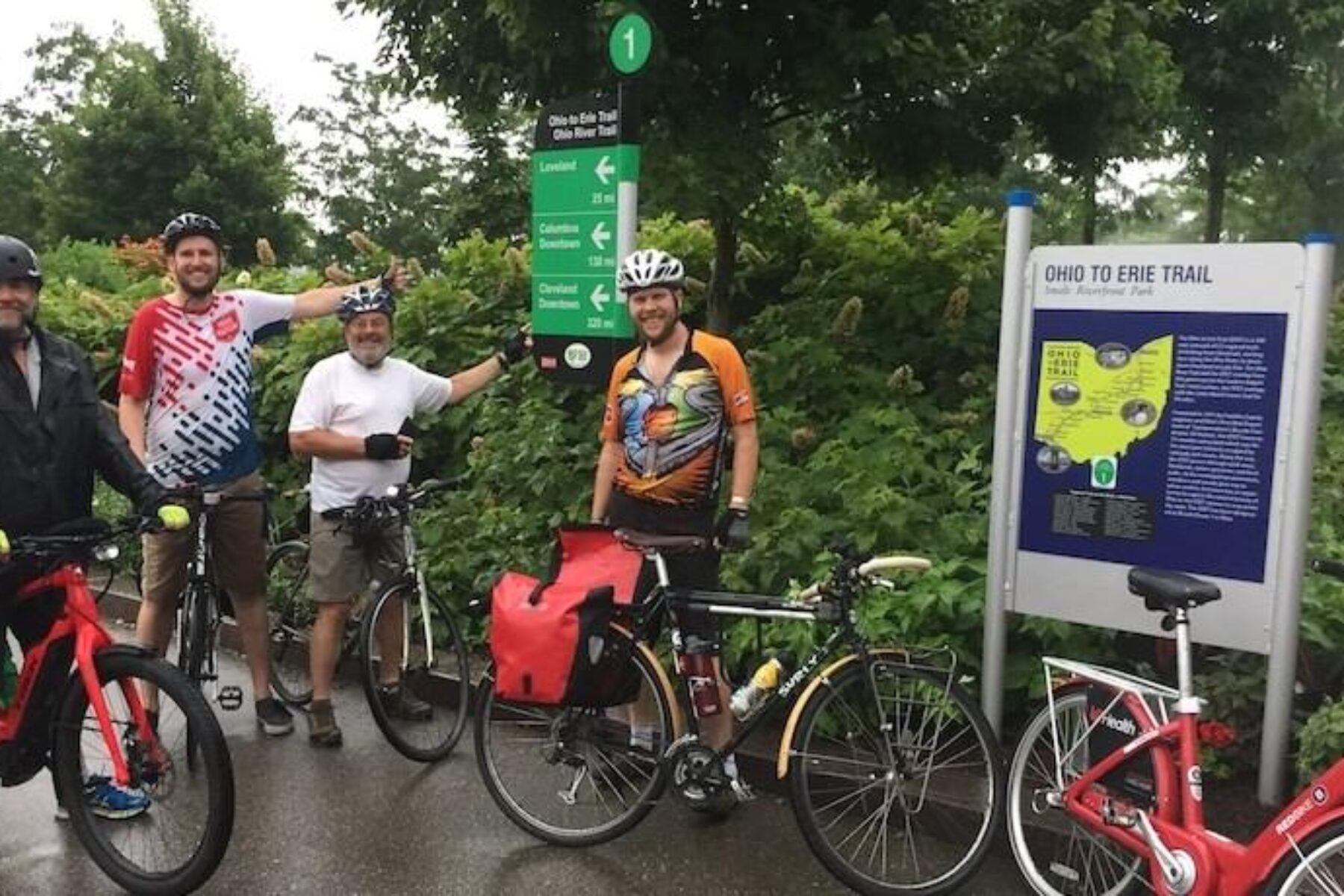
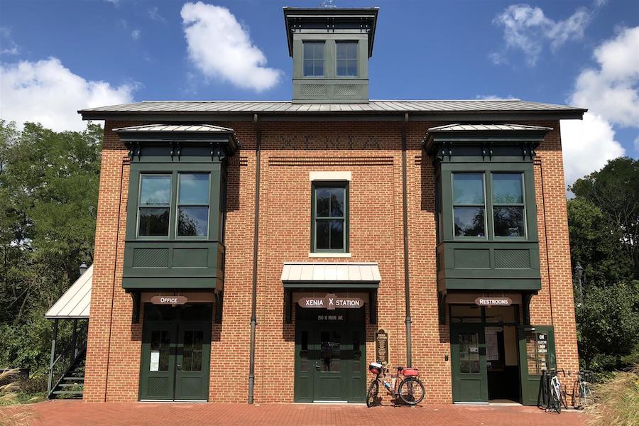
Last month, the small town of Xenia, Ohio—part of the “nation’s largest paved trail network”— welcomed 50 bicycle riders during their statewide ride of the 326-mile Ohio to Erie Trail, bringing attention to how trails significantly enhance Xenia and other communities from an economic and recreational standpoint. Located in the Little Miami River Valley, Xenia is centered at the heart of a five-trail “hub”—the Ohio to Erie Trail, the Prairie Grass Trail, the Creekside Trail, the Xenia Jamestown Connector Trail and, of course, the Little Miami Scenic Valley Trail. This Trails Transform America event also celebrated a recently completed protected bike lane that safely connects the Little Miami Scenic Trail through the heart of downtown without getting lost—or heading into some hairy traffic.
State Agencies Are Breaking Down Silos and Collaborating to Create the Future of Ohio’s Trails
In the past, the Ohio Department of Natural Resources (ODNR) has focused on planning and building recreational trails, while the Ohio Department of Transportation (ODOT) has traditionally worked on designing and constructing transportation trails and protected bike lanes. In the Year of the Trails—and beyond—the two departments are beginning to coordinate their individual efforts to create a comprehensive trail network across the state.
The ODNR is poised to complete its State Trail Plan by the end of 2018 to celebrate Ohio’s Year of the Trails, while the ODOT is working on its future transportation plan with the Ohio Moves Transportation Study. Collaboration between the two agencies will ensure a broader understanding of both urban and rural needs for trails and prioritize both active transportation and recreational trails. Ohio isn’t the first state where transportation and recreation departments have worked together to achieve like-minded goals; in fact, many other states such as Pennsylvania have charted these waters to great success.
Ohio isn’t stopping there! The Ohio Department of Health and ODOT have established a joint Active Transportation Team meant to promote collaboration between agencies. They even put together a grant-funding program to encourage more healthy, active transportation options for Ohio communities. Meanwhile, ODNR has partnered with TourismOhio to develop a trails website and promote the state’s resources. While there is still plenty of work to be done together, these agencies are off to a good start!
Related: It’s Ohio’s “Year of the Trails”—and Big Things Are Happening. (Here Are Six.)
Over the past decade, alongside the growth of cities and small towns in Ohio, there has been a growth in the state’s local and regional trail networks. The events in Northeast Ohio, Southwest Ohio and across the state celebrate the many ways in which these connected networks have helped spur economic development and create healthy, thriving communities.
These developments are proof that communities recognize the benefits of biking and walking—and demonstrate how they are vital to creating balanced transportation systems for Americans. What’s being done in Ohio can be mirrored across the nation to realize the benefits of trail networks for a diverse range of people and places.
So the next time you’re in Ohio, check out these trails—maybe they’ll inspire you to start a project back in your hometown!
This article was co-written by Jordan Mullaney, a Policy Intern at RTC.


Donate
Everyone deserves access to safe ways to walk, bike, and be active outdoors.


